Pennsylvania Amish Country – Landcaster County
 The Amish hold humility as a highly-cherished value and view pride as a threat to community harmony. Because items such as personal photographs can accentuate individuality and call attention to one’s self, they are prohibited from the home. Moreover, the Amish believe that photographs in which they can be recognized violate the Biblical commandment, “Thou shalt not make unto thyself a graven image.” They want to be remembered by the lives they lived and the examples they left, not by physical appearance. Just as the Amish do not carry personal photographs or display them in homes, they do not want others to take photographs of them. Visit Lancaster County to learn more about Pennsylvania Amish Country.
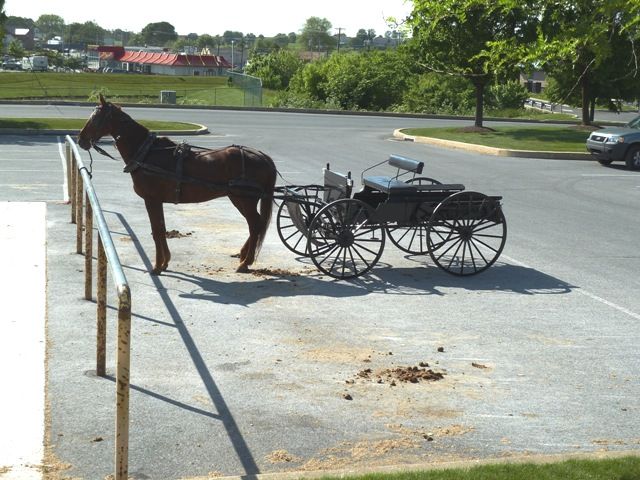
We had a great time spending a few days exploring the area. We honored the Amish way of life and refrained from taking any photos of Amish people. We did however take a nice tour of the communities and visited Intercourse, PA. As with the nearby towns of Bird-in-Hand, Blue Ball, and Paradise, Intercourse is a popular site for tourists because of its location in “Amish country” and its sexually suggestive name. The movie Witness was filmed in Intercourse.
Here are the photos of our visit to Amish Country.
Great Dismal Swamp
 The Great Dismal Swamp is a marshy area on the Coastal Plain Region of southeastern Virginia and northeastern North Carolina between Norfolk, Virginia, and Elizabeth City, North Carolina. One of the first and most famous business supporters of the Great Dismal Swamp was George Washington himself. It was his suggestion to build the actual Canal which was begun in 1793. There is now a system of Canals and Ditches including a feeder ditch from Lake Drummond (approximate center of the swamp) which keeps the system supplied with water. The historic canal is now recognized as part of the National Underground Railroad and noted as a former sanctuary for runaway slaves seeking freedom.
 The Dismal Swamp Canal Trail is a former section of Virginia State Rt. 17, now a multiuse trail open to bicycling, walking, running, horseback riding, and boating. We enjoyed a leisurely bike ride paralleling the canal. Check out the photos of our bike ride on the Dismal Swamp Canal Trail.
Cape Henry Lighthouse
 The Cape Henry Lighthouse silently guards the entry way into the Chesapeake Bay. Standing near the “First Landing” site of the Jamestown settlers where in 1607, Captain Newport raised a cross to offer thanks for their safe crossing of the Atlantic, the Lighthouse has stood sentinel since it was completed in 1792.
It started to crack in 1870 and was replaced with the new Cape Henry Lighthouse only 357 feet away, which is an active aid to navigation and operated by the U.S. Coast Guard.
 We enjoyed a nice climb of over 190 total steps to the top of the old Cape Henry Lighthouse. Quite invigorating considering that the temperature was 86ºF and the humidity was 80%. Not quite what we’re used to … Check out photos of the climb, lighthouses, and surrounding area.
Virginia Beach, VA
 Coming full circle 36 years later. We lived in Virginia Beach, VA back in 1975-1976 when I was in the Navy stationed at Norfolk, VA aboard the USS Barney (DDG6). Our oldest Son was born at the Portsmouth Naval Hospital in 1976 and now he’s serving in the Navy and stationed here himself. Needless to say a few items have changed in the last few years and even though we couldn’t find where we lived back then we had a great time walking on the beach and boardwalk. Just a few weeks ago we were on the west coast and the Pacific Ocean and here we now are walking on a beach at the Atlantic Ocean.
 Check out the photos of our Virginia Beach visit.
Hampton Roads VA Bridge-Tunnel
 The Hampton Roads Bridge-Tunnel is the 3.5-mile-long Hampton Roads crossing for Interstate 64. It is comprised of bridge trestles, manmade islands, and tunnels under the main shipping channels for Hampton Roads harbor. It connects the City of Norfolk to the City of Hampton, VA.
When you travel on the road you don’t get a real sense of the tunnel until you see an aerial view of the complex. Here are some photos of our trip through the tunnel.
“Hampton Roads” is the historic name for the five-mile wide, last ten miles or so of the James River before it empties into Chesapeake Bay. Chesapeake Bay is an ocean estuary, the lower end of which is about 15 miles wide, and Hampton Roads is about 15 miles from the Atlantic Ocean. A line from Old Point Comfort to the west end of Willoughby Spit, comes close to demarking the point where Hampton Roads becomes Chesapeake Bay; and the Hampton Roads Bridge-Tunnel also crosses close to that line.